
 |
2nd Light Forums |
 |
 |  |


|
Topic Title: Weekend Cold Weather Topic Summary: Temps in the 30's Created On: 12/08/2017 07:46 AM |
Linear : Threading : Single : Branch |
|
 Topic Tools Topic Tools
|

 12/15/2017 11:28 AM 12/15/2017 11:28 AM


|
|
|
I was in southern Virginia in 1989. Hatteras and Wrightsville had a blizzard on Christmas Eve that year. We were frozen solid in Virginia but only got a dusting. The storm stayed south and east of us. My relatives in Kitty Hawk went sledding at the Wrigth Bros memorial. It was insanely cold. We saw multiplate nights below 0F and a few days where highs did not exceed 20F in southern Virginia.
------------------------- ... |
|
|
|
|
|
12/16/2017 02:39 AM
|
|
|
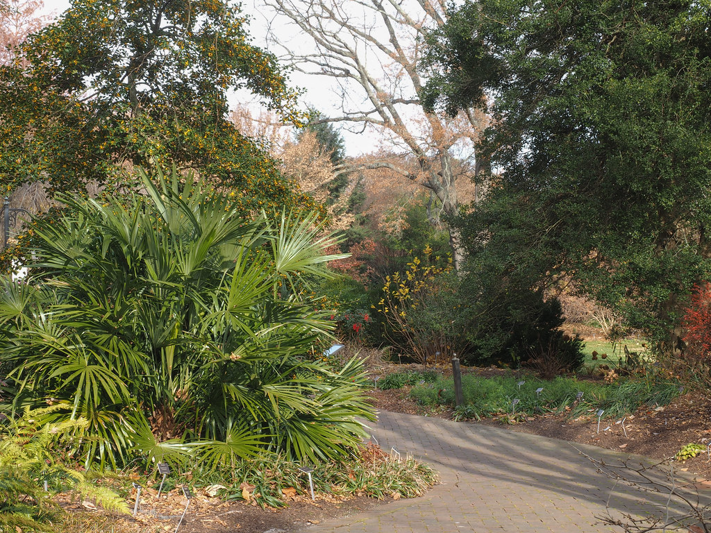
Vero airport was evidently 23 on Dec. 24, 1989. The lowest in 2011 was about 26. The airport's lowest ever was evidently 21. I don't have the year. The 1989 freeze killed royal palms all over Merritt Island and even gumbo limbos at Cocoa Beach, possibly because they'd been left out in the open as specimens rather than sheltered in oak thickets. The 2011 cold did in lots of coconut palms in mainland Vero. A really happy needle palm (Rhapidophyllum hystrix) at the Lewis Ginter Botanical Garden in Richmond, Va.
Edited: 12/16/2017 at 02:48 AM by ww |
|
|
|
|
|
01/01/2018 01:09 PM
|
|
|
Gonna be cold soon, anyone doing anything to prep your palms?
I'm mainly concerned with some young coconut palms and a carambola... ------------------------- Brevard Surf Report |
|
|
|
|
|
01/01/2018 07:28 PM
|
|
|
I moved some potted plants into the porch but everything else is on it's own. I hope the rain stops prior to the plunge Wednesday afternoon. |
|
|
|
|
|
01/02/2018 07:50 AM
|
|
|
It's going to be a close one for the barrier island. From the NWS Melbourne forecast discussion... Clearing skies for Wed night will spell excellent radiational cooling as the coldest air this season spreads southward down the peninsula. Expect overnight mins to fall into the 30s, virtually areawide. Much of rural ECFL may very well realize 3-6 hours of freezing temperatures between 28-32 degrees. As our winds are forecast to remain elevated near 10 mph, also prepare for lowest wind chill readings (apparent temperatures) after midnight/into early Thu morning in the middle 20s, perhaps lower 20s briefly. Freeze warnings/wind chill advisories/warnings may be very likely if models remain consistent.
|
|
|
|
|
|
01/02/2018 09:55 AM
|
|
|
|
|
|
|
|
|
01/03/2018 08:57 AM
|
|
|
The immediate Space and
Treasure coasts (E of I-95) should stay AOA 32 degrees, along with much of Martin County. However, some locations over the interior may see freeze durations of 4-6 hours within rural locations north and west of the I-4 corridor. |
|
|
|
|
|
01/03/2018 08:58 AM
|
|
|
Snowing in Tallahassee today
|
|
|
|
|
|
01/03/2018 04:13 PM
|
|
|
Orchids are in the garage. All other potted tropicals (bromeliads, etc) are in "survival of the fittest mode." (This is the same mode in which I ran my aquariums for years - buy one fish, if it dies, buy no more; if it lives, buy more. Works like a charm!) Unfortunately, my heliconias, cordelines, bananas and tree selloums will look like crap for the rest of the winter but will pop back up come warm weather.
|
|
|
|
|
|
01/04/2018 06:15 AM
|
|
|
my backyard thermometer read 38F. Frost on my car but no where else. no water frozen
|
|
|
|
|
|
01/04/2018 06:17 AM
|
|
|
FLORIDA REGIONAL WEATHER ROUNDUP
NATIONAL WEATHER SERVICE TAMPA BAY RUSKIN FL 700 AM EST THU JAN 04 2018 NOTE: "FAIR" INDICATES FEW OR NO CLOUDS BELOW 12,000 FEET WITH NO SIGNIFICANT WEATHER AND/OR OBSTRUCTIONS TO VISIBILITY. FLZ001>010-012>015-112-114-115-041300- PANHANDLE FLORIDA CITY SKY/WX TMP DP RH WIND PRES REMARKS PENSACOLA CLEAR 28 12 51 NW10 30.23R WCI 19 PENSACOLA NAS CLEAR 28 12 51 NW7 30.25R WCI 21 MILTON NAS CLEAR 25 12 58 NW8 30.22 WCI 16 CRESTVIEW CLEAR 25 12 58 N8 30.21R WCI 16 DUKE FIELD FAIR 25 11 54 NW10 30.19R WCI 15 VALPARAISO CLEAR 27 10 49 NW10 30.20R WCI 17 MARY ESTHER CLEAR 27 11 52 NW8 30.20R WCI 18 PANAMA CITY FAIR 25 13 60 W5 30.17R WCI 19 TYNDALL AFB CLEAR 29 12 49 N8 30.18R WCI 21 APALACHICOLA CLEAR 27 13 55 NW6 30.18R WCI 20 STATION/POSITION SKY/WX TEMP WIND PRES WAVE SWELL AIR SEA DIR/SP/G HT/PER HT/PER (F) (DEG/KT/KT) (MB) (FT/S) (FT/S) 29.2N 88.2W 44 73 350/ 17/ 23 1024.7 28.8N 86.0W 48 71 330/ 16/ 19 1021.5R 6/ 7 PANAMA CITY BEAC 29 53 330/ 8/ 11 1022.5R TOWER C 36 350/ 18/ 21 1021.9R $$ FLZ011-016>038-118-127-128-134-139-239-041300- NORTH FLORIDA CITY SKY/WX TMP DP RH WIND PRES REMARKS MARIANNA CLEAR 26 11 52 W5 30.15R WCI 20 TALLAHASSEE CLEAR 22 14 71 W6 30.14R WCI 14 PERRY CLEAR 23 16 75 SW3 30.14R LIVE OAK CLEAR 23 19 86 MISG 30.12R CROSS CITY CLEAR 26 16 66 W5 30.19R WCI 20 LAKE CITY FAIR 28 18 64 NW6 30.10R WCI 22 GAINESVILLE CLEAR 25 17 72 W6 30.14R WCI 18 WILLISTON N/A 28 21 74 CALM 30.14R PALATKA FAIR 27 19 74 W7 30.11R WCI 19 MAYPORT NAS CLEAR 32 19 58 W12G17 30.07R WCI 23 JACKSONVILLE CLEAR 29 18 63 W8 30.07R WCI 21 JAX NAS CLEAR 31 16 54 W8 30.08R WCI 23 JAX CECIL CLEAR 27 19 74 VRB5 30.08R WCI 21 ST AUGUSTINE CLEAR 28 19 69 W8 30.09R WCI 20 PALM COAST CLEAR 30 21 69 W6 30.10R WCI 24 STATION/POSITION SKY/WX TEMP WIND PRES WAVE SWELL AIR SEA DIR/SP/G HT/PER HT/PER (F) (DEG/KT/KT) (MB) (FT/S) (FT/S) SHELL POINT 30 310/ 6/ 8 1019.7 KEATON BEACH 33 320/ 9/ 12 1020.2R CEDAR KEY 36 350/ 5/ 7 1021.1R FERNANDINA 31 270/ 7/ 10 1018.7R 30.7N 81.3W 52 N/A 4/10 2/11 MAYPORT 32 49 290/ 10/ 15 1018.2R 31.4N 80.9W 36 53 280/ 21/ 27 1015.2R 5/ 5 2/27 ST AUGUSTINE 31 51 260/ 6/ 8 1018.8R $$ FLZ040-043>046-052-053-057-058-063-144-041300- INTERIOR CENTRAL FLORIDA CITY SKY/WX TMP DP RH WIND PRES REMARKS OCALA CLEAR 27 20 75 W3 30.14R LEESBURG CLEAR 34 21 59 MISG 30.14R SANFORD CLEAR 30 21 69 W8 30.12R WCI 22 ORLANDO EXEC CLEAR 34 23 64 NW7 30.12R WCI 28 ORLANDO INTL CLEAR 33 22 63 W7 30.13R WCI 27 KISSIMMEE CLEAR 29 27 92 NW5 30.15R WCI 24 WINTER HAVEN CLEAR 36 19 50 N12 30.15R WCI 28 LAKELAND CLEAR 32 21 64 N6 30.14R WCI 26 BARTOW FAIR 34 18 51 N7 30.14R WCI 28 SEBRING FAIR 34 24 67 NW7 30.15R WCI 28 OKEECHOBEE MOCLDY 32 27 80 NW6 30.13R WCI 26 $$ FLZ041-047-054-059-064-141-147-041300- EAST CENTRAL FLORIDA CITY SKY/WX TMP DP RH WIND PRES REMARKS ORMOND BEACH CLEAR N/A N/A N/A W9 30.11 DAYTONA BEACH CLEAR 29 26 89 W6 30.11R WCI 23 DELAND PTCLDY 30 23 74 W6 30.11R WCI 24 NEW SMYRNA BEA CLEAR 30 25 80 W6 30.11 WCI 24 JFK SPACE CTR CLEAR 33 29 86 NW8 30.11R WCI 25 TITUSVILLE CLEAR 34 28 80 W10 30.13 WCI 26 CAPE CANAVERAL CLEAR 35 24 63 W13 30.10R WCI 27 PATRICK AFB CLEAR 36 28 73 W14 30.11R WCI 27 MELBOURNE CLEAR 34 29 82 MISG 30.12R VERO BEACH CLEAR 35 26 69 NW10 30.12R WCI 27 FT PIERCE CLEAR 36 23 59 NW7 30.12R WCI 30 STUART CLEAR 39 25 56 NW9 30.12R WCI 33 STATION/POSITION SKY/WX TEMP WIND PRES WAVE SWELL AIR SEA DIR/SP/G HT/PER HT/PER (F) (DEG/KT/KT) (MB) (FT/S) (FT/S) 28.5N 80.2W 45 68 300/ 23/ 29 1018.4R 8/10 5/10 TRIDENT PIER 37 63 280/ 12/ 14 1021.1R 28.4N 80.5W 62 N/A 3/11 2/11 27.5N 80.2W 67 N/A 6/10 2/11 $$ FLZ050-056-061-142-242-148-248-149-249-151-251-155-255- 160-260-041300- WEST CENTRAL FLORIDA CITY SKY/WX TMP DP RH WIND PRES REMARKS CRYSTAL RIVER FAIR 34 14 44 NW6 30.15R WCI 29 INVERNESS FAIR 27 23 86 CALM 30.16R BROOKSVILLE CLEAR 31 21 66 N5 30.15R WCI 26 CLEARWATER AIR CLOUDY 36 28 75 CALM 30.14R ST PETE CLEARW CLOUDY 44 33 65 N6 30.14R WCI 41 TAMPA INTL CLOUDY 39 26 59 NE5 30.15R WCI 36 TAMPA EXEC MOCLDY 30 28 93 CALM 30.16R PLANT CITY MOCLDY 34 25 69 N5 30.16R WCI 30 PETER O KNIGHT CLOUDY 37 28 70 NE7 30.15R WCI 32 ST PETERSBURG CLOUDY 45 32 60 NE7 30.13R WCI 41 SARASOTA CLOUDY 38 27 64 E8 30.13R WCI 32 VENICE N/A 39 27 60 NE8 30.15R WCI 34 STATION/POSITION SKY/WX TEMP WIND PRES WAVE SWELL AIR SEA DIR/SP/G HT/PER HT/PER (F) (DEG/KT/KT) (MB) (FT/S) (FT/S) 27.3N 84.2W 72 N/A 6/ 7 CLEARWATER BEACH 48 52 330/ 16/ 19 1020.5R MIDDLE TAMPA BAY 45 30/ 11/ 14 1020.4R VENICE 38 61 60/ 8/ 10 1020.8R $$ FLZ066-069-070-075>078-162-262-165-265-041300- SOUTHWEST FLORIDA AND KEYS CITY SKY/WX TMP DP RH WIND PRES REMARKS PUNTA GORDA CLEAR 32 25 75 NE5 30.16R WCI 27 FT MYERS CLEAR 39 22 50 NE8 30.14R WCI 33 SOUTHWEST INTL CLEAR 36 23 59 MISG 30.15R NAPLES CLEAR 37 22 54 E7 30.14R WCI 32 MARCO ISLAND N/A 39 23 52 N7 30.15R WCI 34 IMMOKALEE MOCLDY 32 25 74 N5 30.16R WCI 27 MARATHON CLOUDY 53 40 61 N18G24 30.10R KEY WEST NAS CLOUDY 54 52 93 N17G23 30.10R KEY WEST INTL CLOUDY 55 51 86 NE14 30.11R STATION/POSITION SKY/WX TEMP WIND PRES WAVE SWELL AIR SEA DIR/SP/G HT/PER HT/PER (F) (DEG/KT/KT) (MB) (FT/S) (FT/S) NAPLES 62 40/ 3/ 5 1020.2R DRY TORTUGAS 61 30/ 20/ 23 1019.0R SAND KEY 56 1019.2R MOLASSES REEF 49 72 360/ 22/ 24 1019.2R $$ FLZ067-068-071>074-168-172>174-041300- SOUTHEAST FLORIDA CITY SKY/WX TMP DP RH WIND PRES REMARKS W PALM BEACH CLEAR 38 21 50 N15 30.11R WCI 29 FT LAUDER-EXEC CLEAR 40 23 50 NW7G17 30.11R WCI 35 FT LAUDERDALE PTCLDY 40 27 59 NW7 30.11R WCI 35 POMPANO BEACH CLEAR 41 21 44 NW14 30.11R WCI 33 PEMBROKE PINES CLEAR 41 28 60 NW7 30.13R WCI 36 OPA LOCKA CLEAR 41 28 60 N8 30.12R WCI 36 MIAMI PTCLDY 44 29 55 NW8 30.12R WCI 39 WEST KENDALL CLEAR 41 32 70 N9 30.12R WCI 35 HOMESTEAD PTCLDY 45 32 60 NW12 30.12R WCI 39 STATION/POSITION SKY/WX TEMP WIND PRES WAVE SWELL AIR SEA DIR/SP/G HT/PER HT/PER (F) (DEG/KT/KT) (MB) (FT/S) (FT/S) PORT EVERGLADES 43 320/ 9/ 12 1019.2 VIRGINIA KEY 44 69 320/ 8/ 11 1019.2R LAKE WORTH 40 68 320/ 14/ 19 1020.3R FOWEY ROCKS 46 73 340/ 22/ 25 1020.3R SETTLEMENT POINT 54 300/ 19/ 23 1017.6R |
|
|
|
|
|
01/04/2018 06:21 AM
|
|
|
Tonight...Surface high pressure across LA/MS late tonight will keep
NNW/NW low level flow across the area. Pressure gradient will support winds to 5-10 mph with stronger winds near the east coast. Mainly clear skies are expected though some scattered cirrus may move toward east central Florida from the Gulf of Mexico late. Guidance temps support lows at or below freezing for all of east central FL, except the barrier islands from Melbourne Beach and along the Treasure coast. Lows along the Martin county coast even on mainland areas should drop into the mid 30s with lower 30s across interior portions of Martin county. Interior areas west of I-4 and most of Volusia county will see lows in the upper 20s. A Freeze Warning will be headlined for all zones. Wind chills will be slighly below ambient air temps in the 20s late at night. |
|
|
|
|
|
01/04/2018 07:21 AM
|
|
|
I'm not a fan of the info above... Guidance temps support lows at or below freezing for all of east central FL, except the barrier islands from Melbourne Beach and along the Treasure coast. Lows along the Martin county coast even on mainland areas should drop into the mid 30s with lower 30s across interior portions of Martin county. |
|
|
|
|
|
01/04/2018 08:11 AM
|
|
|
Location #1: Pineda Causeway & South Tropical Trail; 35.4 F
Location #2 60 Hilliard Lane, 2 miles north of Pineda on Trail; 34.4
|
|
|
|
|
|
01/04/2018 01:17 PM
|
|
|
For Thursday night Friday morning:
Guidance remains in lock step that even lower temperatures are on tap for tonight. After looking at ensemble guidance from both the GFS and ECMWF, have opted to upgrade both Volusia and Lake counties to a Hard Freeze Warning (definition: when forecast temperatures are expected to be 27 degrees or lower for two or more hours). In Volusia County, expect the hard freeze to be confined to areas away from the immediate coast and generally west of I-95. Elsewhere, widespread temperatures at or below freezing are expected, outside of the barrier islands of the Space and Treasure Coasts. |
|
|
|
|
|
01/04/2018 03:00 PM
|
|
|
Tonight...The intense nor`easter off the mid Atlantic coast and
large high pressure over the central U.S. will maintain cold northwest flow overnight. Operational and ensemble guidance continue to support temperatures 3-5 degrees lower than Thursday night, suggesting that both the extent and duration of freezing conditions will be considerably larger. Low temperatures early Friday morning are forecast to reach the middle and upper 20s across Lake and Volusia counties (away from larger bodies of water), with readings in the upper 20s to around 32 degrees for most of the remainder of east central Florida. The exception will be along the barrier island communities from Brevard County southward and along the Intracoastal in St. Lucie and Martin counties, where readings will be in the mid- upper 30s. |
|
|
|
|
|
01/04/2018 03:33 PM
|
|
|
In my area of Palm Bay this morning I had 34 at 6:00AM, supposedly a hour or two at 33 about 3:00AM.
Had some frosted plants/grass, bird baths and some standing water that was frozen and hummingbird feeders that had slush inside. Supposed to see 29 tonight. |
|
|
|
|
|
01/05/2018 11:42 AM
|
|
|
Friday morning, my outdoor thermometer read 40F. no frost. Unscientific.
|
|
|
|
|
|
01/05/2018 03:28 PM
|
|
|
My Friday morning temp never got to the 29, only saw 35.
|
|
|
|
|
|
01/06/2018 06:27 AM
|
|
|
Looks like we are now in a warming trend. No freezes in the next ten days.
This little cold snap should spur the mango to bloom soon. Hoping lychee flower also. |
|
|
|
|

FORUMS
:
Central Florida Palm's Gardening Forum
:
Weekend Cold Weather
|
Topic Tools |
FuseTalk Basic Edition - © 1999-2024 FuseTalk Inc. All rights reserved.