
 |
2nd Light Forums |
 |
 |  |


|
Topic Title: Just let me know when the winds turn offshore.... Topic Summary: Hurricane Humberto Created On: 09/12/2019 03:44 PM |
Linear : Threading : Single : Branch |
 |
- Central Floridave | - 09/12/2019 03:44 PM |
|
- ww | - 09/12/2019 04:16 PM |
|
- Greensleeves | - 09/12/2019 04:54 PM |
|
- cgeis | - 09/12/2019 05:02 PM |
|
- ww | - 09/12/2019 07:55 PM |
|
- scombrid | - 09/13/2019 02:45 AM |
|
- Central Floridave | - 09/13/2019 03:59 AM |
|
- scombrid | - 09/13/2019 06:34 AM |
|
- scombrid | - 09/13/2019 08:02 AM |
|
- Central Floridave | - 09/13/2019 08:17 AM |
|
- tom | - 09/13/2019 09:31 AM |
|
- johnnyboy | - 09/13/2019 10:20 AM |
|
- Greensleeves | - 09/13/2019 10:25 AM |
|
- ww | - 09/13/2019 06:09 PM |
|
- chopola | - 09/14/2019 08:03 AM |
|
- e11even | - 09/14/2019 08:10 AM |
|
- harrietdubman | - 09/14/2019 08:50 AM |
|
- Skunkape | - 09/14/2019 08:57 AM |
|
- SurferMic | - 09/14/2019 09:06 AM |
|
- Skunkape | - 09/14/2019 09:42 AM |
|
- daner | - 09/14/2019 10:40 AM |
|
- hairyDUDE | - 09/14/2019 10:58 AM |
|
- scombrid | - 09/14/2019 11:16 AM |
|
- Cole | - 09/14/2019 07:02 PM |
|
- tom | - 09/15/2019 03:59 AM |
|
- jdbman | - 09/15/2019 05:09 AM |
|
- rathunter | - 09/15/2019 08:38 AM |
|
- seaspray | - 09/15/2019 09:13 AM |
|
- Central Floridave | - 09/15/2019 09:16 AM |
|
- surferclimber | - 09/15/2019 10:53 AM |
|
- Central Floridave | - 09/15/2019 11:34 AM |
|
- harrietdubman | - 09/15/2019 11:41 AM |
|
- StirfryMcflurry | - 09/15/2019 11:45 AM |
|
- harrietdubman | - 09/15/2019 11:48 AM |
|
- LBLarry | - 09/15/2019 12:34 PM |
|
- harrietdubman | - 09/15/2019 12:47 PM |
|
- Julianuribe23 | - 09/15/2019 06:37 PM |
|
- LBLarry | - 09/15/2019 08:46 PM |
|
- harrietdubman | - 09/16/2019 12:28 AM |
|
- LBLarry | - 09/16/2019 11:50 AM |
|
- Central Floridave | - 09/16/2019 03:06 AM |
|
- Central Floridave | - 09/16/2019 12:03 PM |
|
- Central Floridave | - 09/16/2019 12:09 PM |
|
- Central Floridave | - 09/17/2019 07:50 AM |
|
- johnnyboy | - 09/17/2019 05:16 PM |
|
- Central Floridave | - 09/18/2019 05:01 AM |
|
- Central Floridave | - 09/18/2019 05:19 AM |
|
- Central Floridave | - 09/19/2019 04:01 AM |
|
- johnnyboy | - 09/19/2019 08:01 AM |
|
- Central Floridave | - 09/20/2019 06:48 AM |
|
- daner | - 09/20/2019 07:04 AM |
|
- SurferMic | - 09/20/2019 07:20 PM |
|
- daner | - 09/21/2019 05:08 AM |
|
- ww | - 09/21/2019 06:21 AM |
 Topic Tools Topic Tools
|

 09/12/2019 03:44 PM 09/12/2019 03:44 PM


|
|
|
Potential Tropical Cyclone Nine Discussion Number 1
NWS National Hurricane Center Miami FL AL092019 500 PM EDT Thu Sep 12 2019 The disturbance in the southeastern Bahamas has not developed a closed circulation yet, but the cloud pattern is gradually becoming better organized. An Air Force plane is currently approaching the disturbance, and will give NHC more details on the structure of the system. Advisories are being initiated on this system as a Potential Tropical Cyclone to allow for the issuance of a tropical storm warning for a portion of the northwest Bahamas after consultation with the meteorological service of that country. The system is still under the influence of strong shear caused by an upper-level low in the Gulf of Mexico. As the disturbance moves away from the upper low, conditions are expected to be a little more conducive for development as indicated in the intensity forecast. With the exception of the GFS, which forecasts a vigorous trough crossing Florida into the Gulf of Mexico, the remainder of the global models develop a tropical cyclone near the northwestern Bahamas and move it as an intensifying system very close to the east coast of Florida. The NHC forecast opted for the solution of these latter models, however, it is emphasized that given the model discrepancy, both the track and intensity forecasts are highly uncertain, more than usual I would say. Key Messages: 1. The disturbance is expected to become a tropical storm and bring tropical storm force winds to portions of the northwest Bahamas within 36 hours. As a result, advisories have been initiated on Potential Tropical Cyclone Nine. Note that forecast uncertainty for these disturbances is generally larger than for tropical cyclones, especially beyond 48-72 hours. 2. The system is expected to bring tropical-storm-force winds and heavy rainfall to portions of the northwest Bahamas on Friday and Saturday. Significant storm surge is not expected in the northwest Bahamas from this system. Residents there should follow any advice given by local officials. 3. The system could bring tropical-storm-force winds and rainfall to portions of the Florida east coast over the weekend. Residents there should monitor the progress of this system. FORECAST POSITIONS AND MAX WINDS INIT 12/2100Z 23.7N 74.8W 25 KT 30 MPH...POTENTIAL TROP CYCLONE 12H 13/0600Z 24.5N 76.0W 25 KT 30 MPH 24H 13/1800Z 25.5N 77.2W 30 KT 35 MPH...TROPICAL CYCLONE 36H 14/0600Z 26.5N 78.9W 40 KT 45 MPH 48H 14/1800Z 27.5N 80.2W 45 KT 50 MPH 72H 15/1800Z 30.0N 82.0W 30 KT 35 MPH...INLAND 96H 16/1800Z 31.0N 82.0W 25 KT 30 MPH...INLAND 120H 17/1800Z 31.5N 80.0W 30 KT 35 MPH...OVER WATER Edited: 09/18/2019 at 05:02 AM by Central Floridave |
|
|
|
|
|
09/12/2019 04:16 PM
|
|
|
Such a deal. We might get more wind out of this one than Dorian. NHC
|
|
|
|
|
|
09/12/2019 04:54 PM
|
|
|
It should go offshore about the 12th of never
|
|
|
|
|
|
09/12/2019 05:02 PM
|
|
|
https://www.youtube.com/watch?v=nuGSRKMn4WQ
|
|
|
|
|
|
09/12/2019 07:55 PM
|
|
|
Tropical Tidbits, Greensleeves' link. Nice discussion.
|
|
|
|
|
|
09/13/2019 02:45 AM
|
|
|
Most of the 6z model runs (UK and ECMWF) keep it off the east coast. NHC 5AM update reflects this but their forecast is still to the left of the model consensus. Intensity forecasts are ticking up with the possible track staying over water.
------------------------- ... |
|
|
|
|
|
09/13/2019 03:59 AM
|
|
|
Offshore winds possible Sunday/Monday. You guys don't follow directions very well.
SUNDAY Tropical storm conditions possible. Southwest winds 40 to 45 knots with gusts to around 60 knots diminishing to 15 to 20 knots in the afternoon. Seas 12 feet subsiding to 6 feet in the afternoon. Extremely rough on the intracoastal waters. Showers likely and chance of thunderstorms. MONDAY West winds 10 to 15 knots. Seas 4 to 5 feet. A moderate chop on the intracoastal waters. Chance of showers and thunderstorms. |
|
|
|
|
|
09/13/2019 06:34 AM
|
|
|
12Z run of models (except for GFS) remind me of Dennis 1999.
------------------------- ... |
|
|
|
|
|
09/13/2019 08:02 AM
|
|
|
NHC 15Z forecast update reflects the 12Z model runs. Looks favorable so far.
------------------------- ... |
|
|
|
|
|
09/13/2019 08:17 AM
|
|
|
Friday nhc 11 o'clock update shows recurve and heading to Bermuda. Potential Cat 1 in 96 hours. Bring surf and offshore winds please. We need it.
|
|
|
|
|
|
09/13/2019 09:31 AM
|
|
|
------------------------- add a signature since I'm here in profile anyway |
|
|
|
|
|
09/13/2019 10:20 AM
|
|
|
the 12th of never. I hate that its true.
------------------------- "One of the reasons why propaganda tries to get you to hate government is because it's the one existing institution in which people can participate to some extent and constrain tyrannical unaccountable power." Noam Chomsky. |
|
|
|
|
|
09/13/2019 10:25 AM
|
|
|
me too johnny boy but we remain ever optimistic since we are florida "surfers"
should we wax up our big sticks so we can explore the green room? fool us once - shame on you fool us twice - hey we are florida surfers Edited: 09/13/2019 at 10:32 AM by Greensleeves |
|
|
|
|
|
09/13/2019 06:09 PM
|
|
|
8 pm Friday forecast path is even farther offshore and north of the Bahamas.
We're at the edge of the cone of uncertainty; tropical storm watch still in effect.
|
|
|
|
|
|
09/14/2019 08:03 AM
|
|
|
As of Saturday morning, things are beginning to look very interesting.
|
|
|
|
|
|
09/14/2019 08:10 AM
|
|
|
NWS showing due west wind all day SUNDAY and half the day on monday. Get on it tomorrow boys and girls!!!
------------------------- - |
|
|
|
|
|
09/14/2019 08:50 AM
|
|
|
------------------------- sneedeker |
|
|
|
|
|
09/14/2019 08:57 AM
|
|
|
Wed maybe noc so up in our grill ffs poles?
|
|
|
|
|
|
09/14/2019 09:06 AM
|
|
|
Why wait for offshores??? fun/challenging at some locations, Nice to surf with ya again Daner!!!....Pic of some local air droping into oblivion..great air drops today..
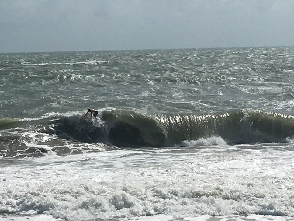
It was kinda thick out there...Icing the back now for round two later... Edited: 09/14/2019 at 09:17 AM by SurferMic |
|
|
|
|
|
09/14/2019 09:42 AM
|
|
|
Grievous
|
|
|
|
|
|
09/14/2019 10:40 AM
|
|
|
Well it was a washing machine out there but but some fun ones. Good seeing you surferMic.
------------------------- Replace turf grass with native plants that don't need irrigation and synthetic fertilizers or chemicals that can go into our waterways and ocean |
|
|
|
|
|
09/14/2019 10:58 AM
|
|
|
What's the call for this week? Best day?
------------------------- Uga Uga!!! |
|
|
|
|
|
09/14/2019 11:16 AM
|
|
|
Wunderground has the best handle on the local wind forecast atm. NWS MLB is leaning too heavily on GFS model output and it has been completely useless of late.
------------------------- ... |
|
|
|
|
|
09/14/2019 07:02 PM
|
|
|
Wunder has it north at twenty for a big part of the day.
http://www.ndbc.noaa.gov/data/...casts/FZUS52.KMLB.html ------------------------- I was right. Edited: 09/14/2019 at 07:05 PM by Cole |
|
|
|
|
|
09/15/2019 03:59 AM
|
|
|
Not yet (following directions)
------------------------- add a signature since I'm here in profile anyway |
|
|
|
|
|
09/15/2019 05:09 AM
|
|
|
S CB streets : Eyeball viz: 8am
Wind is light to calm, swell is somewhere around 3-5 . Some wobble, crinkle. Heading for a 915 high tide, funky scoured out bottom. Gotta look around. ------------------------- So if you are a surfer I wish you the prosperity that allows you more time to pursue the salt water dream, and the true happiness that comes from warm water, clean waves and the companionship of your fellow surfers. If you are an internet troll just spewing bs then f off. |
|
|
|
|
|
09/15/2019 08:38 AM
|
|
|
waves suck
|
|
|
|
|
|
09/15/2019 09:13 AM
|
|
|
There are waves but its not perfect. Head to slightly overhead. N winds got on it around 9 and ruining the form.
|
|
|
|
|
|
09/15/2019 09:16 AM
|
|
|
Thanks for the reports. I'm looking to surf this Sunday afternoon and HOPEFULLY the wind slows down and grooms it better.
|
|
|
|
|
|
09/15/2019 10:53 AM
|
|
|
^
Still looking very windy sloppy- at least up here north of cape Volusia area - hopefully early tommorow will at least be lighter?
DP to start workweek
------------------------- get up early and go surf - it'll make that hangover go away and/or make the workday more tolerable :) Edited: 09/15/2019 at 10:54 AM by surferclimber |
|
|
|
|
|
09/15/2019 11:34 AM
|
|
|
The wind is forecast to be more favorable for Monday DP.
|
|
|
|
|
|
09/15/2019 11:41 AM
|
|
|
------------------------- sneedeker |
|
|
|
|
|
09/15/2019 11:45 AM
|
|
|
Anyone know anything about kite surfing?
|
|
|
|
|
|
09/15/2019 11:48 AM
|
|
|
------------------------- sneedeker |
|
|
|
|
|
09/15/2019 12:34 PM
|
|
|
Anyone know anything about kite surfing? yea its for rich people who can't surf. or perhaps for people that currently live were there is plenty of water and wind .... but shiznit for actual "surf" 98.765% of the time. ------------------------- "Most people would die sooner than think; in fact, they do." - Bertrand Russell "Morality is doing what is right, regardless of what you are told. Religion is doing what you are told, regardless of what is right. If I do not answer you .... nothing personal, I just have you on ignore. |
|
|
|
|
|
09/15/2019 12:47 PM
|
|
|
------------------------- sneedeker Edited: 09/15/2019 at 12:54 PM by harrietdubman |
|
|
|
|
|
09/15/2019 06:37 PM
|
|
|
|
|
|
|
|
|
09/15/2019 08:46 PM
|
|
|
Anyone know anything about kite surfing? yea its for rich people who can't surf. or perhaps for people that currently live were there is plenty of water and wind .... but shiznit for actual "surf" 98.765% of the time. as someone who grew up where the surf is actually terrible for around that percentage annually, was landlocked for the better part of 6 years, and now lives in an even more infrequent surfing locale than where i grew up, i will tell you that some of y'all are serious whiners and would do everyone a favor if you quit surfing/complaining. also: don't forget that two weeks ago a place only a few hundred miles away got completely decimated. take no day for granted let alone the beauty of living in paradise and having the ability to surf something within an hour hour and a half drive max if you actually cared about surfing. F-ing sanctimonious much?? - You were the one that posted the whiny, bitchy, judgmental BS about kite surfing being "for rich people who can't surf" My post was to point out that their can be and are other reasons that someone might want to look for an alternative to "surfing" where the conditions are not favorable the vast part of the time. I am not sure exactly what your f-ing problem is with me but you have know idea where I live, how much I have traveled to find surf ( when you actually had to search and not follow the internet informed hoards) or how much I have given back to the surfing / beach communities through 4 f-ing decades of volunteer work. As for the Bahamas ( a place I have been to in the neighborhood of 200 times to surf and dive) .... I helped 3 different groups in my area gather and send badly needed supplies and will do so several more times in the near future. So take your judgemental BS and stick in your uninformed ass. ------------------------- "Most people would die sooner than think; in fact, they do." - Bertrand Russell "Morality is doing what is right, regardless of what you are told. Religion is doing what you are told, regardless of what is right. If I do not answer you .... nothing personal, I just have you on ignore. Edited: 09/15/2019 at 08:54 PM by LBLarry |
|
|
|
|
|
09/16/2019 12:28 AM
|
|
|
butthurt man makes butt reference ^.
p.s. west winds...
------------------------- sneedeker |
|
|
|
|
|
09/16/2019 11:50 AM
|
|
|
butthurt man makes butt reference ^. p.s. west winds... Tool can't defend his clueless BS .... bye tool. ------------------------- "Most people would die sooner than think; in fact, they do." - Bertrand Russell "Morality is doing what is right, regardless of what you are told. Religion is doing what you are told, regardless of what is right. If I do not answer you .... nothing personal, I just have you on ignore. |
|
|
|
|
|
09/16/2019 03:06 AM
|
|
|
Yup. Monday dp. Pafb W 12
|
|
|
|
|
|
09/16/2019 12:03 PM
|
|
|
Humberto is now a hurricane and if you believe the swell models and virtual buoys looks like it will get bigger thru the week...But, with mostly onshore winds. Unless of course, that is wrong.
The hurricane looks to kick back swell all week. Woot...but, just let me know when the winds turn offshore! |
|
|
|
|
|
09/16/2019 12:09 PM
|
|
|
Volusia-Brevard County Line to Sebastian Inlet 0-20 nm-
1109 AM EDT Mon Sep 16 2019 SMALL CRAFT ADVISORY IN EFFECT THROUGH WEDNESDAY AFTERNOON THIS AFTERNOON North winds 15 to 20 knots. Seas 7 to 9 feet with a dominant period 10 seconds. Choppy on the intracoastal waters. Scattered showers and isolated thunderstorms. TONIGHT North winds 15 to 20 knots. Seas 6 to 9 feet with a dominant period 10 seconds. Choppy on the intracoastal waters. Isolated showers in the evening. TUESDAY North winds 15 to 20 knots. Seas 6 to 9 feet with a dominant period 11 seconds. Choppy on the intracoastal waters. TUESDAY NIGHT North winds 10 to 15 knots. Seas 6 to 9 feet. A light chop on the intracoastal waters. Slight chance of showers. WEDNESDAY Northeast winds 10 to 15 knots increasing to 15 to 20 knots in the afternoon. Seas 6 to 9 feet. Choppy on the intracoastal waters. Chance of showers and slight chance of thunderstorms. WEDNESDAY NIGHT Northeast winds 15 to 20 knots. Seas 8 to 11 feet. Chance of showers and slight chance of thunderstorms. THURSDAY Northeast winds 15 to 20 knots. Seas 7 to 10 feet. Chance of showers. THURSDAY NIGHT Northeast winds 15 to 20 knots. Seas 8 to 11 feet. Chance of showers. FRIDAY East winds 15 to 20 knots. Seas 8 to 11 feet. Slight chance of showers. |
|
|
|
|
|
09/17/2019 07:50 AM
|
|
|
Wind was offshore Tuesday morning, but chances of offshore winds in the morning decrease into Tomorrow. From NWS melbourne
Wed-Sat...Sfc high pressure will build down the eastern seaboard Wed and push a frontal boundary south across the area. NE winds will start out 10-15 knots early Wed but conditions will deteriorate by aftn as a tightening pressure gradient produces a fresh NE flow through late week. Wind speeds of 20 knots with occasional 20-25 knots offshore are expected Wed night through Fri with wind direction veering from NE Wed to East on Friday. Even as "Humberto" continues to move away from the area, large long period swells generated by the hurricane will propagate into the coastal waters and surf zone. Combination of wind wave and swell will produce seas 10-12 feet over the open Atlc/Gulf Stream and 7-9 feet nearshore. A Small Craft Advisory will likely be needed through at least Saturday and a High Surf Advisory will likely be needed for the entire EC FL coast beginning Wed night or Thu. |
|
|
|
|
|
09/17/2019 05:16 PM
|
|
|
It was magic before the winds turned. That was about 11am in Palm Beach County.
------------------------- "One of the reasons why propaganda tries to get you to hate government is because it's the one existing institution in which people can participate to some extent and constrain tyrannical unaccountable power." Noam Chomsky. |
|
|
|
|
|
09/18/2019 05:01 AM
|
|
|
Maximum sustained winds are near 115 mph (185 km/h) with higher
gusts. Humberto is a category 3 hurricane on the Saffir-Simpson Hurricane Wind Scale. Some fluctuations in intensity are likely during the next day or so, but Humberto should remain a powerful hurricane through early Thursday. A steady weakening trend should begin later on Thursday. Hurricane-force winds extend outward up to 60 miles (95 km) from the center and tropical-storm-force winds extend outward up to 175 miles (280 km). The eye of Hurricane Humberto passed over NOAA buoy around 500 AM AST (0900 UTC). The buoy measured a sustained wind of 76 mph (122 km/h) and a wind gust to 90 mph (145 km/h) at 4-meters elevation, and also reported a pressure of 954.2 mb (28.18 inches) during the eye passage. |
|
|
|
|
|
09/18/2019 05:19 AM
|
|
|
Victory At Sea next several days. wind models show strong onshore winds thru at least Monday. Chop Hop surfing.
Volusia-Brevard County Line to Sebastian Inlet 0-20 nm- 404 AM EDT Wed Sep 18 2019 SMALL CRAFT ADVISORY IN EFFECT THROUGH SATURDAY AFTERNOON TODAY Northeast winds 10 to 15 knots. Seas 6 to 9 feet with a dominant period 12 seconds. A moderate chop on the intracoastal waters. Slight chance of showers in the morning, then chance of showers in the afternoon. THURSDAY Northeast winds 15 to 20 knots increasing to 20 to 25 knots in the afternoon. Seas 8 to 11 feet. Rough on the intracoastal waters. Chance of showers. FRIDAY East winds 15 to 20 knots. Seas 8 to 11 feet. Choppy on the intracoastal waters. Slight chance of showers. SATURDAY East winds 15 to 20 knots. Seas 8 to 11 feet. Slight chance of showers. SUNDAY East winds 10 to 15 knots. Seas 5 to 7 feet. |
|
|
|
|
|
09/19/2019 04:01 AM
|
|
|
Gulp. 120 mile buoy reading 16 feet 14 seconds.
|
|
|
|
|
|
09/19/2019 08:01 AM
|
|
|
It is blown out basura. Its good exercise.
------------------------- "One of the reasons why propaganda tries to get you to hate government is because it's the one existing institution in which people can participate to some extent and constrain tyrannical unaccountable power." Noam Chomsky. |
|
|
|
|
|
09/20/2019 06:48 AM
|
|
|
Hopefully this onshore wind crap dies out by the time we start seeing a swell from Jerry.
Volusia-Brevard County Line to Sebastian Inlet 0-20 nm- 419 AM EDT Fri Sep 20 2019 SMALL CRAFT ADVISORY IN EFFECT THROUGH SUNDAY MORNING TODAY East winds 20 to 25 knots diminishing to 20 knots in the late morning and afternoon. Seas 8 to 11 feet with a dominant period 13 seconds. Rough on the intracoastal waters. Chance of showers. TONIGHT East winds 15 to 20 knots. Seas 8 to 11 feet with a dominant period 13 seconds. Choppy on the intracoastal waters. Slight chance of showers. SATURDAY East winds 15 to 20 knots. Seas 7 to 10 feet with a dominant period 13 seconds. Choppy on the intracoastal waters. Slight chance of showers. SATURDAY NIGHT East winds 15 to 20 knots. Seas 6 to 9 feet. Choppy on the intracoastal waters. SUNDAY East winds 15 to 20 knots. Seas 6 to 8 feet. Choppy on the intracoastal waters. SUNDAY NIGHT East winds 15 to 20 knots diminishing to 10 to 15 knots after midnight. Seas 6 to 8 feet. MONDAY Northeast winds 10 to 15 knots. Seas 4 to 6 feet. MONDAY NIGHT Northeast winds 5 to 10 knots. Seas 4 to 6 feet. TUESDAY Northeast winds 5 to 10 knots. Seas 3 to 5 feet. |
|
|
|
|
|
09/20/2019 07:04 AM
|
|
|
Hopefully this onshore wind crap dies out by the time we start seeing a swell from Jerry.t. It's going to be close- unfortunately. ------------------------- Replace turf grass with native plants that don't need irrigation and synthetic fertilizers or chemicals that can go into our waterways and ocean |
|
|
|
|
|
09/20/2019 07:20 PM
|
|
|
^^^^Hey Daner ..no show at the spot tonight???.was fair/good, thumping rinse repeat ...

Edited: 09/21/2019 at 04:26 AM by SurferMic |
|
|
|
|
|
09/21/2019 05:08 AM
|
|
|
Too windy for me. But glad you had fun.
------------------------- Replace turf grass with native plants that don't need irrigation and synthetic fertilizers or chemicals that can go into our waterways and ocean |
|
|
|
|
|
09/21/2019 06:21 AM
|
|
|
Windy mess this morning, swell has shrunk.
|
|
|
|
|
|
FORUMS
:
Surfing
:
Just let me know when the winds turn offshore....
|
Topic Tools |
FuseTalk Basic Edition - © 1999-2024 FuseTalk Inc. All rights reserved.